Charleston County, in partnership with the South Carolina Department of Transportation (SCDOT) is studying improvements to HWY 78 between Rivers Avenue (US 52) and the intersection of HWY 78 and Berlin G. Myers Parkway (SC 165). The study area is generally located along the existing alignment of HWY 78 for approximately 8.0 miles between Rivers Avenue and Berlin G. Myers Parkway. This project is currently proposed to be wholly funded by Charleston County as part of the Transportation Sales Tax Program. The project will follow the provisions of the Federal Environmental Process as to remain eligible for federal funding and to ultimately comply with provisions of Section 404 of the Clean Water Act.
The HWY Route 78 Corridor is a known source of congestion in the tri-county area. Important features along the corridor include the Wannamaker County Park, Trident Medical Center, Charleston Southern University, and the Exchange Park (fairgrounds).
HWY 78 serves as a vital connection to I-26 and provides a direct route between Summerville and North Charleston.
The corridor also contains dense commercial, industrial, and residential development with numerous driveway access points and unsignalized intersections. The SCDOT, Berkeley-Charleston-Dorchester Council of Governments (BCDCOG), Dorchester County, and Charleston County have all explored options for improvements within the corridor. Past and ongoing studies and projects include, but are not limited to:
The SCDOT I-26 Corridor Management Plan.
The SCDOT HWY 78 University Boulevard Roadway Safety Assessment.
HWY 78, College Park Road, and Ladson Road Intersection Alternative Traffic Analysis.
Medical Plaza Drive/Excellence Way at HWY 78 Intersection Improvements.
Shadow Lane and Elms Plantation at HWY 78 Intersection Improvements.
Widening of U.S. Route 78 (Dorchester County Phase 3B) to Berlin G. Meyers Parkway.
BCDCOG Lowcountry Rapid Transit Project.
Some segments of the BCDCOG Lowcountry Rapid Transit (LCRT) project fall within the HWY 78 project study limits, from Exchange Park & Fairgrounds to Rivers Avenue. Due to this overlap the County project team has been coordinating closely with the BCDCOG, and that coordination will continue until the HWY 78 Improvements project is complete.
The purpose and need sets the stage for consideration of the alternatives and is a key element/baseline used by the Lead Federal Agency to determine the Preferred Alternative. It has three parts, the purpose, the need, and goals and objectives.
The purpose defines the transportation problem to be solved.
The need provides data to support the purpose.
The goals and objectives describe other issues that need to be resolved as part of a successful solution to the problem.
Purpose
The purpose of the proposed project is to accommodate projected increases in traffic volume by improving roadway capacity, efficiency of key intersections, and system continuity throughout the project limits.
Need
This section of roadway serves as a principal arterial that has historically experienced an increase in traffic due to regional growth, and currently sustains operations that exceed the capacity of the current roadway system and are projected to worsen over time.
The project seeks to implement capacity and system improvements along this currently congested corridor segment, due at least in part to a high rate of residential growth in the region over the last 20 years. The proposed project will accomplish the following objectives:
Improve capacity along HWY 78 from Rivers Avenue to Berlin G. Myers Parkway.
Provide safe opportunities for bicyclists and pedestrians.
Reduce congestion and increase capacity at key intersections along the project corridor.
Schedule & Path Ahead
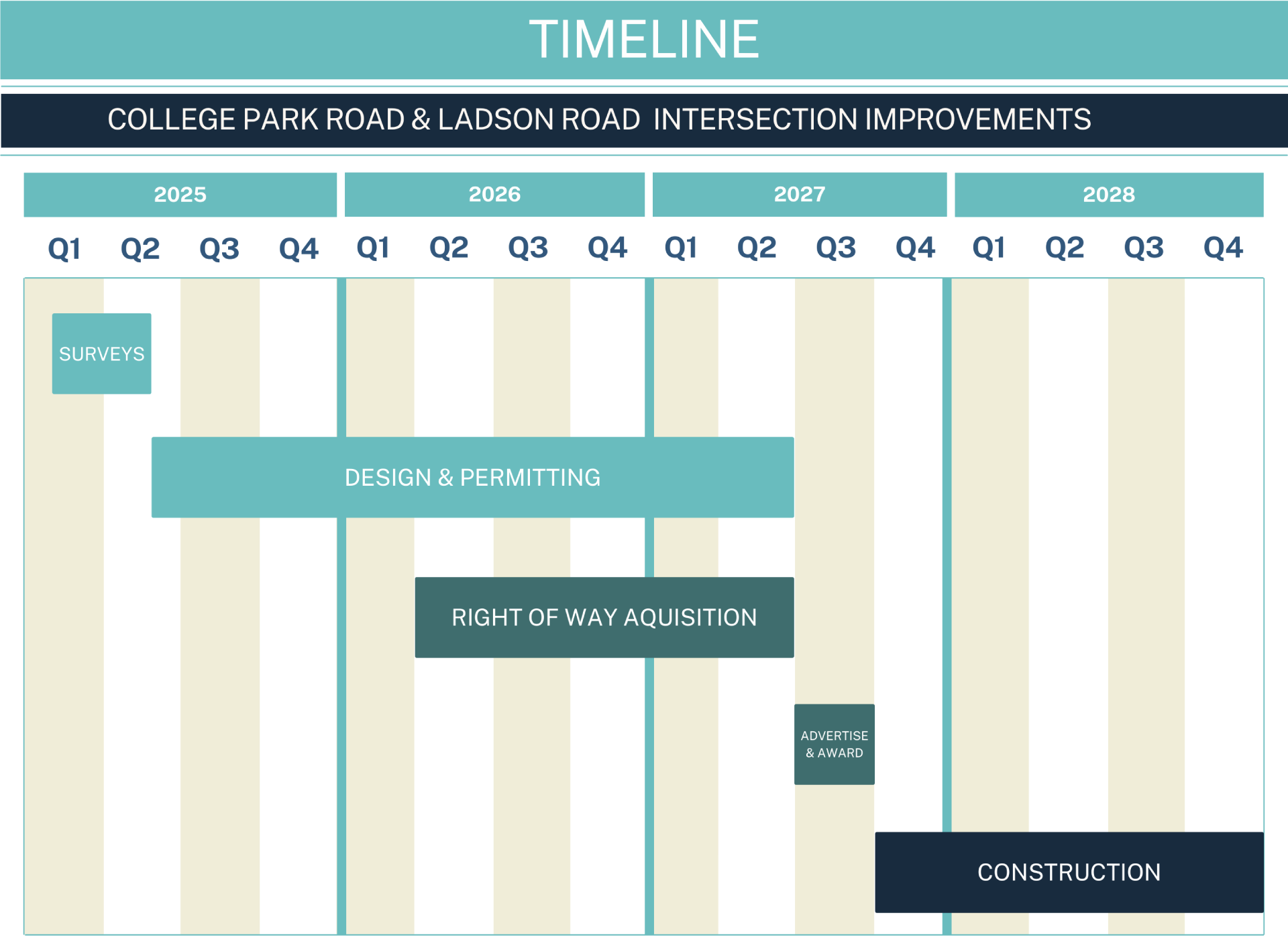
Based on traffic studies, public and stakeholder comments, and cost, Charleston County has determined that only improvements at the Hwy 78/College Park Road/Ladson Road intersections will be advanced. Other components of the Hwy 78 Project will not be implemented at this time. The proposed schedule for the Hwy 78/College Park Road/Ladson Road intersection is shown below. Click to enlarge.
 View Spanish Version